


Epic Adventures
-
Link to my current 2024 inReach Map
Link to my early 2024 inReach Map
Link to the 2023 MoRT & MsRT Map
Links:
You can see what I be seening on: facebook.
-
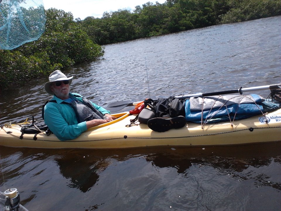
2023 - Missouri & Mississippi Rivers, Again! no map
October 15, 2023 by: Warren
There are a few paddlers that paddle the BIG rivers each year. Eight to 12 will complete the 2200-mile Missouri River - starting in western Montana and ending at the Arches at St Louis. Slightly more, maybe 20 or so, will paddle the Mississippi River. That trip is 2200 miles broken in two parts: the Upper and the Lower; segmented at the confluence of the Ohio and the Mississippi near Cario - 190 miles below St Louis. Few of the Missouri paddlers will continue down the Mississippi, perhaps one or two. The combined trip is more than 3800 miles, making it the fourth longest river in the world.
This year I started at Ft Benton MT and pulled out at Natchez MS - 2900 miles, 125 days. Low water and erosions controls (lining the river sides with rock) made the camping on the Missouri difficult. While the record setting low water on the Mississippi provided seemingly endless beaches - great for camping, poor for crowding the tows and paddlers into narrow twists and turns.
With the intention to continue paddling to the Keys and hopefully beyond, I have stopped in Alabama to do a bit of walking - sitting on one's butt for 4 months will certainly weaken the legs.
Links:
You can see what I saw on: facebook.
-
2022 - North by Northeast map
Feburary 15, 2022 by: Warren
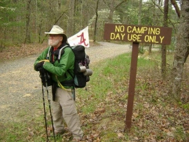
Having too much free time and better than average health leads one to make curious decisions. So, at 71, not sick since childhood, and able to carry thirty-five pounds for several hours a day, off I went to see the world. Starting at Heflin on the Alabama Pinhoti Trail - 78 miles, completed. Then 168 miles on Georgia's Pinhoti and 127 miles of the Benton MacKaye found me at mile 370 and in Fontana Village NC on March 27.
After a weekend of unscheduled rest - thanks to the women at the Resort's front desk I continued north by northeast.
After 200 days on the trail I grew tired of camping and eating cold meals. 200 days had put me at AT mile 1756 (of 2195) and quick math sez: I had 1591 miles on the AT and 370 miles of the AL/GA Pinhoti and Benton McKaye trails.
And then, at age 72, I was good with that so I went home.
Follow me at inReach, See what I see on facebook. - 2020 - Idaho Centennial Trail, Section Hike info
June 25, 2020 by: Warren
The 900-mile Idaho Centennial Trail (ICT) is a scenic trail through Idaho. It winds its way through various ecosystems from high desert, canyons, mountains, and high plains. June was too early for a Spring hike thru the mountains, so we FINISHED doing the 160 desert-miles and are holding up until the CCP Virus attacks Idaho or until the snow melt-off lessen the dangers of stream crossings. OR... as it turned out, until Diane fully recovers from her knee surgery.
Read more about the: ICT or See The Map - 2020 - Pacific Crest Trail, retry
August April 4, 2020 by: Warren
Something about MikeŌĆÖs Place, snow, SARS-CoVid 2, and a fortunate set of circumstances goes
. Perhaps I write it later, but probably not. IŌĆÖm only 69, I not afraid of dying. However being sick on the trail and far far from home isnŌĆÖt my idea of a fun hike. And thereŌĆÖs a chance that getting off of a trail during a ŌĆślock downŌĆÖ isnŌĆÖt the adventure that one seeks, espeacially during a plague if you are depending on someone to feed the pet fox(s). No more - 2019 - Pacific Crest Trail map
August 28, 2019 by: Warren
After several twists & turns and lengthy travel by taxi, plane, bus, train, and busŌĆ” and a morning hitch because of a snowy overnight in southern California that delayed the morning bus ŌĆ”and a brief one-mile road-walk, we managed to reach the PCT trailhead at the US/Mexican border on Friday morning, February 22. After a convoluted 125-mile northbound hike dodging the snow and ice-cold rain we found ourselves heading into even more snow yet. Clearly, with an unusual two-month late winter with 150% of the December snowfall in February, we and the other early-2019 starters needed a better plan. Read more
- 2018 - Upper Mississippi River Paddle Trail map
August 1, 2018 by: Warren
Having paddled 950 miles of the Lower Mississippi between St Louis and Baton Rouge in the spring of '17 and not having many epic rivers remaining to test, we headed for the 1367-mile Upper Mississippi. Starting near the faux source, Lake Itasca, of the mighty Ms, we headed to a pull-out above St Louis. Hoped for more time so we could go further... the river is undammed below the Chain of Rocks. The first hundred miles were news to us - we perfer to keep planning to the minimum. Then things were as expected. Then the flooding began and the fun slipped away. Facebook
- 2017 - FL's Circumnavigational Saltwater Paddle Trail map
September 16, 2017 by: Warren
A segmented paddling trip. 2017-Part Three: May 6 - September 14, 2017. Following a u-haul portage between Baton Rouge LA and Spanish Fort AL, a re-launch in Mobile Bay and a paddle of Florida's Circumnavigational Saltwater Paddle Trail before being forced off of the water on Day 131 by Hurricane Irma at FCT Mile 1324, Cocoa FL. Read End Cap
- 2017 - Lower Mississippi River map
May 2, 2017 by: Warren
A segmented paddling trip. 2017-Part Two: March 9 - May 2, 2017. Launching in St Charles MO and paddling 950 miles of the Mississippi River in 52 days before pulling out in Baton Rouge due to continued flooding and a week of horrific winds. Click: Other paddlers decided quitting was wise too.
- 2016 - Missouri River Trail Paddle Trail map
December 5, 2016 by: Warren
A segmented paddling trip. 2016-Part One: June 20 - October 20, 2016. 122 days paddling 2,100 miles of the Missouri River and five of its great lakes, ending in St Charles MO. Capped with an end-to-end-to-end yo-yo of the famed Katy Trail; or '500 Miles using $100 Walmartainment bicycles...'
- 2011/12 - FL's Circumnavigational Saltwater Paddle Trail map
December 8, 2012 by: Warren
A two part kayak trip paddling over 2300 miles. Part One: starting on the Tennessee River at Guntersville AL and stopping in Panacea FL after 74 days; Part Two: continuing from Panacea and ending in Savanah GA after 124 days. Read More
- 2010 - an Epic Double-Crossing of the United States map
December 8, 2010 by: Warren
A 207 day, 10,000 mile bicycle ride thru 28 states, starting and ending in Alabama while spending only 3 nights indoors. Read More
- 2009 - Alabama Scenic River Trail map
December 8, 2009 by: Warren
A 107 day Forrest Gump paddle of the longest in-one-state river trail - 647 miles; downriver(s) then upriver(s) then downriver some more. Read More
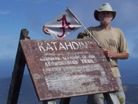
- 2008 - Appalachian Trail - 2548 miles, Alabama to Maine map
April 8, 2009 by: Warren
Started March 17th 2008 on Alabama's Pinhoti Trail, then Georgia's Pinhoti, then a seciton of the Benton MacKaye and finally connecting to the A.T. in Fontana Village 350 miles later. Ending in Maine in October and then seven weeks bicycling another 1700 miles to homeless-sweet-homeless. Read More
October 15, 2023 by: Warren
Haruki Murakami says, | "Everybody has to be somewhere..." |
|---|---|
|
So I am off to be somewhere. |
Garmin's inReach Map above includes a method to send me a message by satillite, though it is not real-time messaging; more ten-minute-ish like.
Notes & News
- Newer News from the Florida Paddling Trails Association
Finish Trip 2 in 2018
- a.k.a. gubbool on the web.
1 years ago from web
- 'Old' News in The Birmingham News written by Thomas Spencer
14 years ago from web
- Warren gets his fifteen minutes... on Alabama's Rick & Bubba Radio Show
14 years ago from web
- Honourable Mention on the ASRT
Scroll way down to numbers seven and twenty-seven15 years ago from web
- Old Notes on a Time Line
17 years ago from web